Cadron Settlement Park
Located just west of Conway off Highway 64. Trail Notes: This trail is best ridden in a clockwise direction. Enter at the trailhead on the left (you'll see "MTB" in yellow on a tree). There is 5-6 miles of trail. The "Outer Loop" is marked with yellow squares on trees. It is fairly technical and is intended for intermediate level riders. The "Inner Loop" is marked with orange squares and consists of a pea gravel type surface. It is rideable by all skill levels. There is no running water to fill your water bottles, but there is a bathroom facility.
Directions to the trailhead from The Ride
From The Ride head N on N Donaghey Ave. Turn left onto Hwy 64W/Washington Ave. Travel on Hwy 64W for approx 4.2miles. Turn left onto Hwy 319W. Cadron Settlement Park is located approx 1 mile on the right hand side of the road at the end of this Hwy. Park in the parking area on the left as you enter the park.
Cadron Ridge Trail
The Ridge Trail connects West Conway (Centennial Valley) with Cadron Settlement Park via a trail that climbs and follows the ridge. We have permission to ride and/or hike/run this trail. No ATV or motorized traffic is allowed (on the park trails either for that matter). You can access the trail from the cart path off of Bay Hill Rd in Centenial Valley or from the cul-de-sac at the end of Lost Canyon Dr. Once you climb to the top of the ridge from either of these trails, you can stay on top of the ridge and ride the ridge trail back and forth or you can head over to the water tower on the east end of the Ridge where you can head down to Hwy 319 to access the park. Please note the Ridge Trail is closed on the far west end at the pipeline junction. DO NOT continue onto the pipeline or past the pipeline.
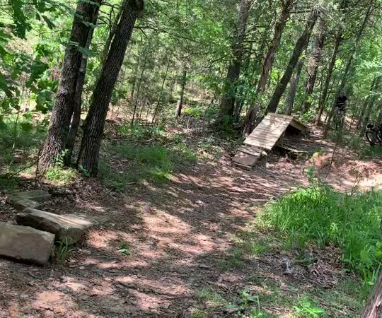
Enders Fault
Located north of Greenbrier at Woolly Hollow State Park. The trailhead is at the gravel parking lot on Historic Springfield Road past the park campground. The entrance starts on the east side of the parking lot next to the bike fix-it station. Ride the trail into the woods past the hiking trail (no bikes on that please) and then through a big berm, down the hill through a small creek and a left goes to the North Loop (clockwise), a right goes to the South Loop (counter-clockwise). The North Loop features winding rolling hills and a couple of wonderful stream crossings. These will be dry beds during the Summer. Some tight turns and a few rocks are the most technical parts of this section. The South Loop features a steep climb to get to the top of the hill across the lake but then opens up to quick, smooth trail. Again, rolling hills dominate this section. Since what goes up, must come down, enjoy the trip back down the mountain to the start. Beginner riders should check their speed on this section. The park also features a beach area open in the summer for a small fee along with bathrooms, showers, a snack bar and gift shop.
Mt. Nebo Monument Trails
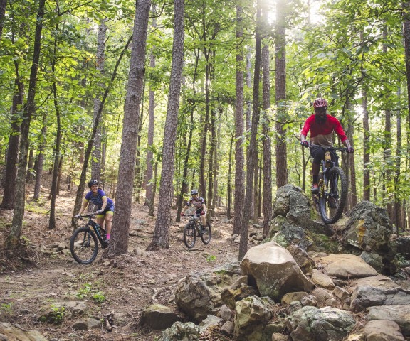
Mount Nebo State Park is a 1,750 ft mountain escape in the heart of the Arkansas River Valley. This 25-mile Monument Trail system has something for everyone, including spectacular views, waterfalls, pine forests, winding rock gardens, and gravity - down and up. The drive-up Highway 155 will begin your memorable trip to the mountain top, trailers longer than 24ft not recommended.
Whatever loop you decide to do, post ride grab a beverage at the Visitors' Center and clean your bike off at the Bike Wash Station. If you're lucky, you may see a hang glider take off from the east side of the Visitors' Center. You can cool off at the pool and then head into Dardanelle for your choice of local restaurants.
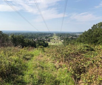
Pinnacle Mountain Monument Trails
Just west of Arkansas’s capital city of Little Rock, Pinnacle Mountain stands as the centerpiece of this geographically diverse state park. This day-use park offers a variety of outdoor adventure on the Big and Little Maumelle Rivers, in the Arkansas Arboretum, and along over 15 miles of trails including 7 miles of challenging mountain bike trails. Hike to the top, explore the rivers, or take in one of the many interpretive programs offered by park staff. Visit the park visitor center, enjoy a picnic, or reserve a pavilion for a larger gathering.
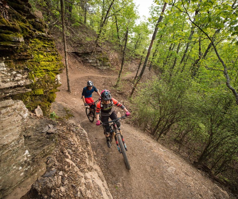
Rattlesnake Ridge Natural Area
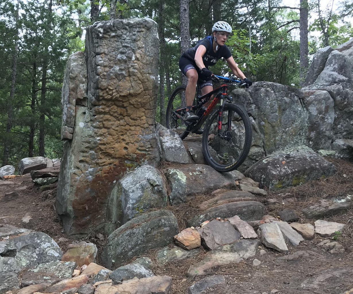
Just west of Pinnacle Mountain State Park, down Barrett Road, just before the bridge over the Little Maumelle River, on the right, you’ll find Rattlesnake Ridge Natual Area. The property is managed by The Nature Conservancy partnered with the Arkansas Department of Natural Heritage. The terrain is similar to Pinnacle Mountain with beautiful views from the top of the ridge and rocky woodlands on the slopes. The property goes from the ridge south to Barrett Road, the other side of the ridge is owned by Central Arkansas Water. Mitchell Allen with The Nature Conservancy manages the property and is responsible for much of the trail construction including the incredible bridges. Affordable Trail Solutions was hired to construct the trails, the first machine built mountain bike trails in the Little Rock area.
The trail is rated mainly intermediate to expert, if you’re looking for more of a beginner trail, check out Grilled at Boyle Park in midtown Little Rock. There are currently about 5 miles of trails with more on the way. There are many rock features, most with ride-arounds and some nice berms, jumps, and drops. It is a mountain bike playground where riders can work on skills.